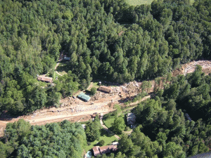
It may not have shaken the Richter scale like the stampede of Republican lawmakers and their realtor and developer lobbyists in Raleigh back in 2011, clamoring to cut funding for the State’s Landslide Hazard Mapping (LHM) program; but there were more than 50 landslides across Western North Carolina and East Tennessee after the recent heavy rains. Thankfully, to my knowledge, there was no loss of life associated with these slides.
That wasn’t the case back in 2004 when remnants of Hurricane Frances and/or Ivan dumped torrential rains on the area causing the Peeks Creek slide in Macon County that killed five people and destroyed 15 homes. Peeks Creek was a major impetus for the creation of North Carolina’s 2005 Hurricane Recovery Act, which provided funding for the Landslide Hazard Mapping. But it wasn’t the only event: From the bill itself:
“…During Hurricane Ivan, the community of Peeks Creek was devastated by a debris flow triggered by the heavy rains. The debris flow traveled speeds as great as 33 miles per hour for two and a quarter miles from the top of Fishhawk Mountain. Five persons were killed, and 15 homes destroyed by the flow that was estimated to be several hundred feet wide and up to 40
feet high.
“…Sixty-two homes were destroyed, and 11,107 homes suffered damage in Hurricane Frances. Another 78 homes were destroyed, and 5,127 homes damaged in Hurricane Ivan. Eighty-five landslides were reported…”
Landslides are not new phenomena in the U.S. The U.S. Geological Survey estimates that landslides create more than $3.5 billion in damages and kill between 25 and 50 people each year, and it comes as no surprise that mountainous areas like Western North Carolina are prime landslide candidates.
The task of the LHM program was to identify these areas in North Carolina’s 19 western most counties. A daunting task, but one the North Carolina Geological Survey was well equipped to handle. In fact, NCGS had completed three counties (Macon, Buncombe and Watauga) and started on Jackson when funding was pulled. Using the best available mapping technology, both aerial and from the ground, plus hours of field work by trained geologists NCGS was (and is) able to determine where landslides have occurred in the past – the most likely place for future slides. Peeks Creek was the site of at least two previous debris flows.
The LHM program was on pace to be wrapped up by 2014 at a total cost of around $3.6 million ($355,000 for 10 years.) So by cutting the program in 2011 business-savvy lawmakers saved taxpayers $1.4 million. It only cost taxpayers $3.2 for the cleanup at Peeks Creek and one slide in Maggie Valley had a $1.4 million price tag. One can only home that the next home or homes to slide down a mountainside are vacant and the only costs to consider are property costs.
North Carolina lawmakers may be able to assign a dollar value to human life but I certainly can’t. Especially when we have the tools available to prevent these kinds of tragedies from happening.

